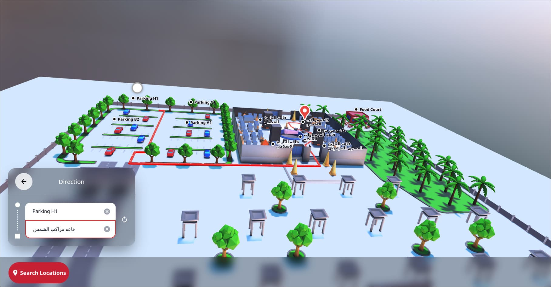
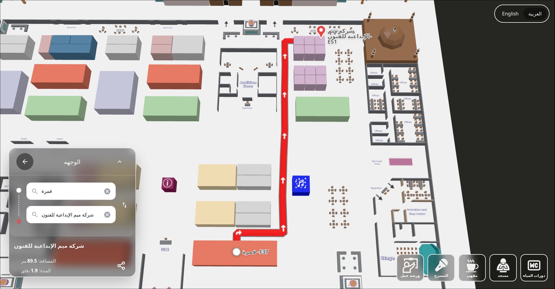
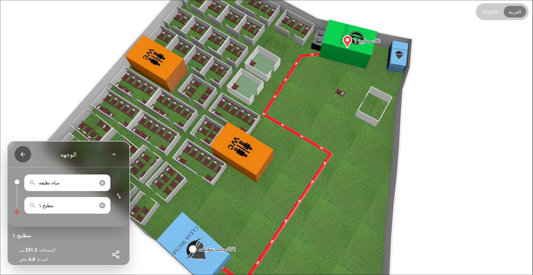
Mapping the Maximum Possibilities

Immersive experience for your visitors

We create a comprehensive solutions that puts sustainability, aesthetics and empowering your business, Checkout all demos.

MaxMap

15-30%

Usage Rate of total visitors – users interacting with wayfinding (kiosks, apps, signs)

6-10 min

Reduction in average wayfinding time

95%

Reduction in dwell time at decision points

85%

Increase in user satisfaction at events

80%

Reduction in staff direction requests

75%

Total staff-time saved

90%

Cost saving in printings, signage, logistics

35%

Increase in foot traffic to key areas

Your Business Depends On Strong Foundations

Empowering Success, Establishing Solid Foundations Essential for Sustainable Business Growth and Performance.

100% Clients Strongly Endorse to Partners

Features

Everything you need to organize your thoughts

Core Navigation Features

  • Interactive Digital Maps
    • Zoomable 2D/3D floor plans with real-time updates.
    • Landmark-based directions.
  • Turn-by-Turn Directions
    • Voice-guided and/or text-based navigation (multilingual support).
    • AR overlays (e.g., arrows on live camera view).
  • Point of Interest (POI) Search
    • Filter by category (e.g., restrooms, exits, sponsors).
    • "Save Favorite Locations" for quick access.

Hardware & Infrastructure

  • Digital Signage/Kiosks
    • Touchscreen displays with real-time updates.
    • QR codes linking to mobile apps.
  • Beacon Technology
    • Bluetooth/Wi-Fi/UWB for indoor positioning (<1m accuracy).
    • Proximity-based notifications (e.g., "You're near the keynote stage!")
  • RFID/NFC Tags
    • Tap-to-navigate for accessibility users.

Software & Integration

  • Mobile App Integration
    • Sync with event or venue apps.
    • Offline mode for low-connectivity areas.
  • CMS (Content Management System)
    • Real-time updates (e.g., closed routes, session changes).
    • Sponsor/advertiser content scheduling.
  • API Integrations
    • Calendar sync (e.g., Navigate to your next meeting).
    • Crowd data (e.g., Tawakkalna for density alerts).

Accessibility & Inclusivity

  • Voice Navigation
    • Screen reader compatibility.
  • Tactile/Braille Maps
    • Physical maps for visually impaired users.
  • High-Contrast/Large Text
    • ADA/WCAG/Saudi SASO compliance.

Analytics & Reporting

  • Heatmaps
    • Track foot traffic density (e.g., Zebra MotionWorks).
  • User Behavior Analytics
    • Dwell time, popular routes, drop-off points.
  • ROI Dashboards
    • Exhibitor visit rates, sponsor engagement.

Safety & Emergency Features

  • Emergency Evacuation Routes
    • Dynamic rerouting during incidents.
  • Push Alerts
    • Notifications for closures/hazards.

Success Stories & Case Studies

Real-world implementations of MaxMap wayfinding solutions

Saudi Book Fairs & Riyadh International Book Fairs

Saudi Film Confex 2024

Saudi Food Feast 2023

Biban2024

Build with MaxMap

Optimize and increase the efficiency of your enterprise with complete indoor experiences for enterprises across markets.

Events demo
Airports demo
Stadiums demo
Malls demo
Offices demo

Frequently Asked Questions

Quick answers to common questions about our products and services.

1. General Questions

2. Technology & Features

3. Cost & Implementation

4. Privacy & Data

5. Accessibility

6. Maintenance & Updates

7. ROI & Metrics

8. Emergency Use

9. Future-Proofing

10. Common Concerns